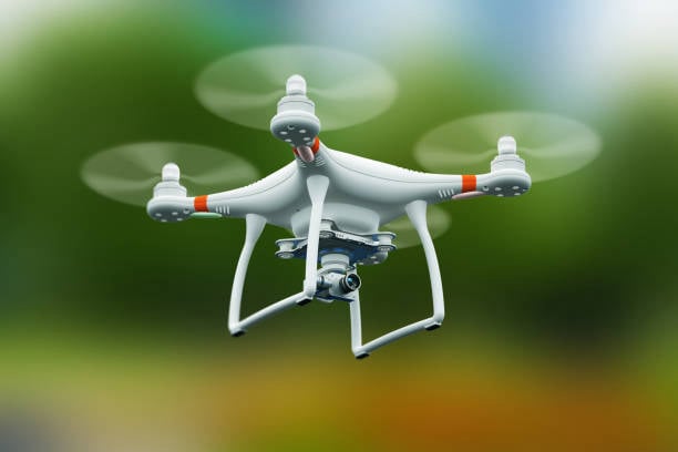
Aerial photography using a drone is the art of capturing images from elevated angles using unmanned aerial vehicles (UAVs). It provides sweeping, high-resolution views of landscapes, structures, or events that would be impossible or costly to achieve with traditional photography methods.
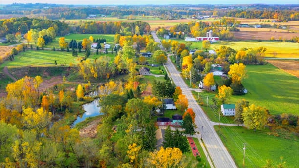
From showcasing vast farmlands to highlighting architectural beauty from above, drone photography delivers a fresh, elevated perspective—literally and creatively.
Unlike traditional aerial methods (like helicopters or planes), drones offer affordable, agile, and precise access to elevated viewpoints—making them ideal for everything from creative projects to industrial applications.
Unique Perspectives - Capture landscapes, architecture, and events from dramatic, elevated angles
Cost-Effective - No need for helicopters or cranes—just a drone and a skilled pilot
High-Resolution Imaging - Modern drones shoot in 4K+ and 20MP+, rivaling DSLR quality
Agility & Access - Fly through tight spaces, over water, or above terrain that’s hard to reach
Real-Time Framing - Live FPV (first-person view) lets you compose shots on the fly
Drone videography captures stunning motion footage from the sky, offering sweeping cinematic views that ground-based cameras can’t replicate. Whether soaring over natural landscapes or gliding through urban skylines, it transforms everyday scenes into breathtaking visual stories—elevating perspectives, quite literally.
With stabilized gimbals and high-resolution cameras, drones can glide, orbit, and sweep through scenes—delivering cinematic visuals that were once only possible with helicopters or cranes.
Unique Perspectives - Capture bird’s-eye views, dramatic reveals, and impossible angles
Smooth Motion - Gimbals and flight control create buttery-smooth cinematic movement
Cost-Effective - Achieve Hollywood-style shots without big-budget equipment
Agile & Versatile - Fly through tight spaces, over water, or around structures
Real-Time Monitoring - View and adjust shots live via FPV (first-person view) feed
We can generate detailed 3D models and maps for construction, mining, and land development. This service uses drones equipped with high-resolution cameras, LiDAR, or multispectral sensors to capture detailed data of the Earth’s surface. The result? Accurate 3D models, contour maps, and elevation profiles that are essential for planning, design, and analysis across industries.
Orthomosaic Maps - High-res, distortion-free aerial maps stitched from hundreds of images
3D Point Clouds - Dense sets of georeferenced points used to model terrain and structures
Digital Surface Models (DSM) - Elevation data including buildings, trees, and other surface features
Digital Terrain Models (DTM) - Bare-earth elevation data with vegetation and structures removed
Contour Lines - Elevation lines for topographic planning and grading
Assess crop health, irrigation needs, and pest infestations using multispectral imaging.
Agricultural monitoring with drones equipped with advanced sensors and cameras to collect real-time data on crop health, soil conditions, water usage, and more. It’s a cornerstone of precision agriculture, helping farmers make informed decisions that boost yield and reduce waste.
Crop Health Monitoring - Multispectral and NDVI imaging to detect stress, disease, or nutrient deficiencies
Irrigation Management - Thermal sensors identify over- or under-watered zones for optimized water use
Pest & Disease Detection - Early identification of infestations before they spread
Soil Analysis - Assess moisture, pH, and nutrient levels to guide fertilization and planting